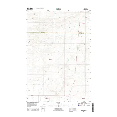
2014 Map of Melville NW
USGS Topo · Published 2014About this map
Fish Cr and Sadie Cr carve their way through the high plains of central Montana along the jurisdictional divide between Wheatland and Sweet Grass counties. This 2014 survey captures a landscape defined by expansive ranch lands and a sparse network of section roads, where the primary north-south artery of Us-191 serves as the lifeline for the region. The map illustrates the Public Land Survey System grid in detail, showing how land ownership and livestock operations are organized across townships like t5n r14e and t6n r15e. Local family and geographical names are preserved in the road network, from Bill Donald Rd in the northwest to Tony Creek Rd in the southeast. This document is a clear record of modern western land use, highlighting the persistent importance of water sources like Cayuse Cr in an arid environment.
Find a feature on this map
16 named features on this map. Tap any name to fly to it.
Don’t see what you’re looking for? This feature index may not catch every label — zoom into the map to look around manually.
Map Details
Editions of this 2014 Melville NW Map
This is the sole edition of this map. No revisions or reprints were ever made.
Other maps of this area

1886 · Little Belt Mts.
USGS Topo · 1:250,000

1889 · Big Snowy Mountain
USGS Topo · 1:250,000

1893 · Big Snowy Mountain
USGS Topo · 1:250,000

1894 · Little Belt Mts.
USGS Topo · 1:250,000

1897 · Little Belt Mts.
USGS Topo · 1:250,000

1898 · Little Belt Mts.
USGS Topo · 1:250,000

1902 · Little Belt Mts.
USGS Topo · 1:250,000

1948 · White Sulphur Springs
USGS Topo · 1:250,000

1954 · Roundup
USGS Topo · 1:250,000

1958 · Roundup
USGS Topo · 1:250,000