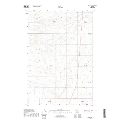
2020 Map of Melville NW
USGS Topo · Published 2020About this map
The border of Wheatland and Sweet Grass counties divides this high-plains landscape, where ranching and irrigation define the land use. The presence of the Martin and Cremer Ditch in the southern portion of the map indicates the significant effort required to manage water for agriculture in this semi-arid region. Several seasonal and perennial watercourses, including Fish Cr, Sadie Cr, and Cayuse Cr, carve through the terrain, influencing the layout of local infrastructure. Transportation through these open reaches relies on a network of unpaved corridors like Tony Creek Rd and Donald Rd, which connect remote properties to the primary north-south artery, Highway 191.
Find a feature on this map
14 named features on this map. Tap any name to fly to it.
Don’t see what you’re looking for? This feature index may not catch every label — zoom into the map to look around manually.
Map Details
Editions of this 2020 Melville NW Map
This is the sole edition of this map. No revisions or reprints were ever made.
Other maps of this area

1886 · Little Belt Mts.
USGS Topo · 1:250,000

1889 · Big Snowy Mountain
USGS Topo · 1:250,000

1893 · Big Snowy Mountain
USGS Topo · 1:250,000

1894 · Little Belt Mts.
USGS Topo · 1:250,000

1897 · Little Belt Mts.
USGS Topo · 1:250,000

1898 · Little Belt Mts.
USGS Topo · 1:250,000

1902 · Little Belt Mts.
USGS Topo · 1:250,000

1948 · White Sulphur Springs
USGS Topo · 1:250,000

1954 · Roundup
USGS Topo · 1:250,000

1958 · Roundup
USGS Topo · 1:250,000