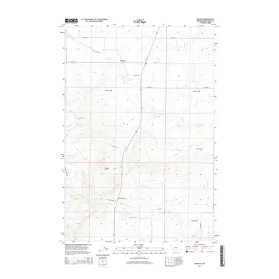
2014 Map of Melville
USGS Topo · Published 2014About this map
Melville serves as the focal point of this ranching landscape in Sweet Grass County, where the plains of south-central Montana meet the rising elevations of the foothills. The community is positioned near the confluence of Billy Cr and Sweet Grass Cr, water sources that have historically dictated the placement of homesteads and transportation routes in this part of the state. A network of country roads, including Melville Rd, Donald Rd, and Bill Donald Rd, connects the scattered holdings across the territory.
Find a feature on this map
26 named features on this map. Tap any name to fly to it.
Don’t see what you’re looking for? This feature index may not catch every label — zoom into the map to look around manually.
Map Details
Editions of this 2014 Melville Map
This is the sole edition of this map. No revisions or reprints were ever made.
Other maps of this area

1886 · Little Belt Mts.
USGS Topo · 1:250,000

1889 · Big Snowy Mountain
USGS Topo · 1:250,000

1891 · Livingston
USGS Topo · 1:250,000

1891 · Big Timber
USGS Topo · 1:125,000

1893 · Livingston
USGS Topo · 1:250,000

1893 · Big Snowy Mountain
USGS Topo · 1:250,000

1893 · Big Timber
USGS Topo · 1:125,000

1894 · Little Belt Mts.
USGS Topo · 1:250,000

1897 · Little Belt Mts.
USGS Topo · 1:250,000

1898 · Little Belt Mts.
USGS Topo · 1:250,000