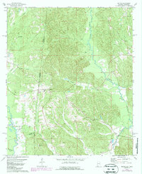
1978 Map of Melvin
USGS Topo · Published 1987About this map
The Old Indian Treaty Boundary slices diagonally across this rural borderland between Choctaw County, Alabama, and Clarke County, Mississippi, marking a significant historical line through the piney woods. Centered on the settlement of Melvin, the landscape is defined by the winding paths of Okatuppa Creek and Buckatunna Creek. This mid-1970s survey highlights the local prominence of rural faith and community life, evidenced by a high density of country churches including Donald Ch, Shady Grove Ch, and Victory Grove Ch, alongside the Zion Chapel Cem.
Find a feature on this map
33 named features on this map. Tap any name to fly to it.
Don’t see what you’re looking for? This feature index may not catch every label — zoom into the map to look around manually.
Map Details
Editions of this 1978 Melvin Map
This is the sole edition of this map. No revisions or reprints were ever made.
Other maps of this area

1953 · Hattiesburg
USGS Topo · 1:250,000

1953 · Meridian
USGS Topo · 1:250,000

1957 · Meridian
USGS Topo · 1:250,000

1957 · Quitman
USGS Topo · 1:62,500

1958 · Hattiesburg
USGS Topo · 1:250,000

1964 · Carmichael
USGS Topo · 1:24,000

1964 · Matherville
USGS Topo · 1:24,000

1965 · Meridian
USGS Topo · 1:250,000

1974 · Melvin
USGS Topo · 1:24,000

1974 · Silas
USGS Topo · 1:24,000