
1957 Map of Quitman
USGS Topo · Published 1958About this map
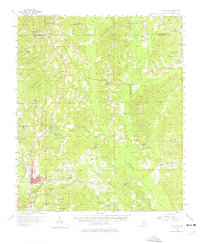
Quitman serves as the focal point of this late-1950s survey, situated along the Chickasawhay River and the Gulf Mobile and Ohio railroad. The landscape is dense with small rural congregations and family burial grounds, reflecting the deep-rooted social fabric of Clarke County. Notable sites include the historic Archusa Springs and the Confederate Cem located near the town center. To the north, Clarkco State Park surrounds Moore Creek, while the surrounding terrain is defined by a complex network of timbered ridges and creek valleys such as Bucatunna Creek and Archusa Creek. The prevalence of landmarks like the Quitman Lookout Tower and numerous country churches, including Hebron Ridge Ch and Rolling Creek Ch, provides a clear view of the area's mid-century rural development before the expansion of modern highways.
Find a feature on this map
68 named features on this map. Tap any name to fly to it.
Don’t see what you’re looking for? This feature index may not catch every label — zoom into the map to look around manually.
Map Details
Editions of this 1957 Quitman Map
2 editions found
Other maps of this area

1921 · Meridian
USGS Topo · 1:48,000

1923 · Meridian
USGS Topo · 1:62,500

1953 · Hattiesburg
USGS Topo · 1:250,000

1953 · Meridian
USGS Topo · 1:250,000

1957 · Meridian
USGS Topo · 1:250,000

1957 · Chunky
USGS Topo · 1:62,500

1957 · Enterprise
USGS Topo · 1:62,500

1958 · Hattiesburg
USGS Topo · 1:250,000

1964 · Carmichael
USGS Topo · 1:24,000

1964 · Hale
USGS Topo · 1:24,000