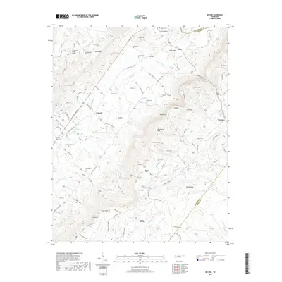
2019 Map of Melvine
USGS Topo · Published 2019About this map
Sequatchie Valley settlement patterns are clearly defined by the steep topography of the Cumberland Plateau to the west and Walden Ridge to the east. The Sequatchie River meanders through this corridor, supporting small rural clusters like Melvine, Litton, and Ninemile. These communities are anchored by numerous family burial grounds such as Hamilton Cem and Swafford Chapel Cem, which reflect the generations of residents who farmed the fertile valley floor. The geography is characterized by dramatic elevation shifts, where the Cumberland Escarpment drops sharply toward the valley. Local landmarks such as Worthington Cave and the gap at Big Spring highlight the karst and spring-fed hydrology of the region, while the transition from the valley to the high ridges is marked by prominent points like Worthington Knob and Clayton Knob.
Find a feature on this map
127 named features on this map. Tap any name to fly to it.
Don’t see what you’re looking for? This feature index may not catch every label — zoom into the map to look around manually.
Map Details
Editions of this 2019 Melvine Map
This is the sole edition of this map. No revisions or reprints were ever made.
Other maps of this area

1887 · Kingston
USGS Topo · 1:125,000

1891 · Kingston
USGS Topo · 1:125,000

1892 · Pikeville
USGS Topo · 1:125,000

1893 · Kingston
USGS Topo · 1:125,000

1895 · Pikeville
USGS Topo · 1:125,000

1909 · Sequatchie Valley
USGS Topo · 1:62,500

1910 · Pikeville
USGS Topo · 1:62,500

1912 · Crossville
USGS Topo · 1:62,500

1935 · Melvine
USGS Topo · 1:24,000

1935 · Morgan Springs
USGS Topo · 1:24,000