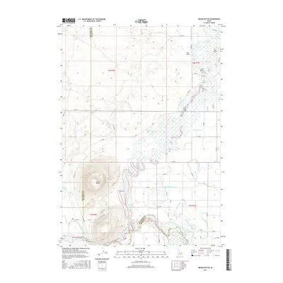
2017 Map of Menan Buttes
USGS Topo · Published 2017About this map
The Menan Buttes rise sharply from the volcanic plain, defining the border between Jefferson and Madison counties. This landscape is a complex network of volcanic geology and high-desert hydrology, where the Snake River braids into numerous channels and sloughs. Man-made infrastructure like the Saint Anthony Canal and Liberty Park Canal intersects with natural features such as Texas Slough and Bannock-Jim Slough, illustrating the intensive irrigation efforts that support agriculture on the Egin Bench.
Find a feature on this map
57 named features on this map. Tap any name to fly to it.
Don’t see what you’re looking for? This feature index may not catch every label — zoom into the map to look around manually.
Map Details
Editions of this 2017 Menan Buttes Map
This is the sole edition of this map. No revisions or reprints were ever made.
Other maps of this area

1948 · Rigby
USGS Topo · 1:24,000

1948 · Lewisville
USGS Topo · 1:24,000

1948 · Parker
USGS Topo · 1:24,000

1949 · Rexburg
USGS Topo · 1:24,000

1949 · Rigby
USGS Topo · 1:24,000

1949 · Lewisville
USGS Topo · 1:24,000

1949 · Roberts
USGS Topo · 1:62,500

1950 · Ririe
USGS Topo · 1:24,000

1950 · Parker
USGS Topo · 1:24,000

1950 · Rexburg
USGS Topo · 1:24,000