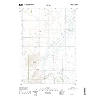
2020 Map of Menan Buttes
USGS Topo · Published 2020About this map
Menan Buttes rise as the most prominent geological feature on this landscape, straddling the boundary between Jefferson and Madison counties. This volcanic terrain is marked by evocatively named routes like Rustlers Trl and Outlaw Pass, suggesting a rugged history of movement across the high ground. To the east and north, the land transitions into a complex aquatic network where the Snake River feeds an intricate system of sloughs and irrigation works.
Find a feature on this map
57 named features on this map. Tap any name to fly to it.
Don’t see what you’re looking for? This feature index may not catch every label — zoom into the map to look around manually.
Map Details
Editions of this 2020 Menan Buttes Map
This is the sole edition of this map. No revisions or reprints were ever made.
Other maps of this area

1948 · Rigby
USGS Topo · 1:24,000

1948 · Lewisville
USGS Topo · 1:24,000

1948 · Parker
USGS Topo · 1:24,000

1949 · Rexburg
USGS Topo · 1:24,000

1949 · Rigby
USGS Topo · 1:24,000

1949 · Lewisville
USGS Topo · 1:24,000

1949 · Roberts
USGS Topo · 1:62,500

1950 · Ririe
USGS Topo · 1:24,000

1950 · Parker
USGS Topo · 1:24,000

1950 · Rexburg
USGS Topo · 1:24,000