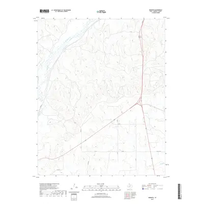
2019 Map of Mendota
USGS Topo · Published 2019About this map
Red Deer Creek and its many tributaries, including Washburn Arroyo and Simmons Creek, carve a complex drainage pattern across this portion of the Texas Panhandle. The landscape is defined by the contrast between these winding watercourses and the straight-line grid of the region's transport network. A concentration of industrial activity is centered at the Gas Plant in the southwestern corner, reflecting the energy economy that sustains many of these high plains communities. The small settlements of Mendota and Arlington serve as localized hubs along the county road system, connected by routes like Co Rd 4 and Co Rd 7. This 2019 survey documents the enduring spatial relationship between ranching infrastructure, such as Ranch Rd 3044, and the ephemeral creeks that shape the Hemphill County terrain.
Find a feature on this map
16 named features on this map. Tap any name to fly to it.
Don’t see what you’re looking for? This feature index may not catch every label — zoom into the map to look around manually.
Map Details
Editions of this 2019 Mendota Map
This is the sole edition of this map. No revisions or reprints were ever made.
Other maps of this area

1954 · Amarillo
USGS Topo · 1:250,000

1958 · Amarillo
USGS Topo · 1:250,000

1967 · Mendota
USGS Topo · 1:24,000

1967 · Dads Creek
USGS Topo · 1:24,000

1967 · Young Ranch
USGS Topo · 1:24,000

1967 · Canadian SE
USGS Topo · 1:24,000

1967 · Lora
USGS Topo · 1:24,000

1972 · Washburn Arroyo
USGS Topo · 1:24,000

1972 · Canadian West
USGS Topo · 1:24,000

1972 · East Dry Creek
USGS Topo · 1:24,000