
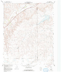
1967 Map of Lora
USGS Topo · Published 1970About this map
Red Deer Creek and the Washita River dominate the landscape in this section of the Texas Panhandle, where the terrain transitions from eroded creek breaks to the high plains. The Atchison Topeka and Santa Fe railroad line parallels the creek, serving the small settlement of Lora, while a Roadside Park provides a rest stop for travelers along the nearby highway. Genealogy researchers can locate the Miami Cem in the western portion of the map, situated near the rolling hills that separate the water drainages. The map also delineates the Roberts Co Hemphill Co boundary and highlights the significance of water in this semi-arid region through labels for the Mather Well and various other wells and tanks. Industrial presence is noted by a prominent Pipeline and several gravel pits, reflecting the local infrastructure of the late 1960s.
Find a feature on this map
14 named features on this map. Tap any name to fly to it.
Don’t see what you’re looking for? This feature index may not catch every label — zoom into the map to look around manually.
Map Details
Editions of this 1967 Lora Map
2 editions found
Other maps of this area

1954 · Amarillo
USGS Topo · 1:250,000

1958 · Amarillo
USGS Topo · 1:250,000

1963 · Mobeetie
USGS Topo · 1:24,000

1966 · Laketon
USGS Topo · 1:24,000

1967 · Mendota
USGS Topo · 1:24,000

1967 · Young Ranch
USGS Topo · 1:24,000

1967 · Tody School
USGS Topo · 1:24,000

1972 · Washburn Arroyo
USGS Topo · 1:24,000

1972 · Miami
USGS Topo · 1:24,000
1972 · Horse Creek South
USGS Topo · 1:24,000