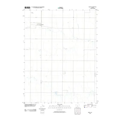
2009 Map of Menlo
USGS Topo · Published 2009About this map
Menlo occupies a high point on the plains between two significant water systems in Thomas County. The community's local grid is defined by streets like 2nd St, E St, and F St, while the surrounding section lines form a rigid lattice of rural routes. To the north of town, the Menlo Cemetery serves as a primary genealogical landmark. The landscape is drained by the winding course of Sand Creek, which cuts across the central townships, while the South Fork Solomon River flows through the southern portion of the quadrangle. This 2009 survey highlights the intersection of modern infrastructure and the natural drainage patterns of the High Plains, with County Line Rd marking the eastern extent of the survey area.
Find a feature on this map
14 named features on this map. Tap any name to fly to it.
Don’t see what you’re looking for? This feature index may not catch every label — zoom into the map to look around manually.
Map Details
Editions of this 2009 Menlo Map
This is the sole edition of this map. No revisions or reprints were ever made.
Other maps of this area

1954 · Goodland
USGS Topo · 1:250,000

1956 · Goodland
USGS Topo · 1:250,000

1957 · Goodland
USGS Topo · 1:250,000

1979 · Menlo
USGS Topo · 1:24,000

1979 · Rexford
USGS Topo · 1:24,000
1979 · Rexford NE
USGS Topo · 1:24,000

1979 · Grinnell NE
USGS Topo · 1:24,000

1979 · Oakley North
USGS Topo · 1:24,000
1979 · Breton
USGS Topo · 1:24,000
1979 · Grinnell North
USGS Topo · 1:24,000