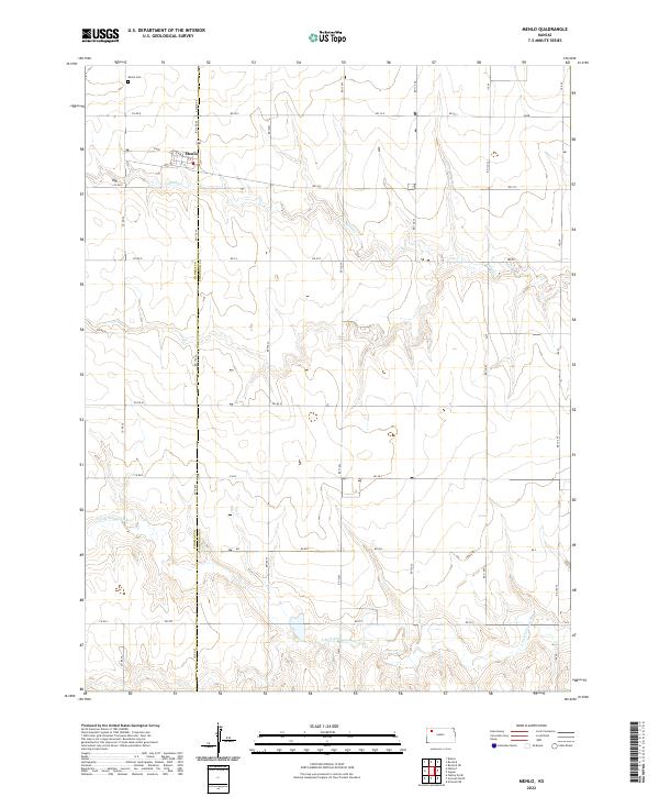
2022 Map of Menlo
USGS Topo · Published 2022About this map
Menlo serves as the primary settlement on this High Plains landscape, situated along the border of Thomas Co Sheridan Co. The town site is organized around a traditional grid including H Ave, G Ave, and E St, reflecting a classic mid-continental agricultural hub. To the north, the Menlo Cem stands as a permanent record of the local community's history. The terrain is defined by the winding paths of the S Fork Solomon River in the south and Sand Cr near the town, where the drainage patterns reveal the subtle elevation changes of the Kansas prairie. A dense network of section-line roads, such as Co Rd Q and Co Rd 37, highlights the systematic land division that has shaped farming and ranching in the region for generations.
Find a feature on this map
36 named features on this map. Tap any name to fly to it.
Don’t see what you’re looking for? This feature index may not catch every label — zoom into the map to look around manually.
Map Details
Editions of this 2022 Menlo Map
This is the sole edition of this map. No revisions or reprints were ever made.
Other maps of this area

1954 · Goodland
USGS Topo · 1:250,000

1956 · Goodland
USGS Topo · 1:250,000

1957 · Goodland
USGS Topo · 1:250,000

1979 · Menlo
USGS Topo · 1:24,000

1979 · Rexford
USGS Topo · 1:24,000
1979 · Rexford NE
USGS Topo · 1:24,000

1979 · Grinnell NE
USGS Topo · 1:24,000

1979 · Oakley North
USGS Topo · 1:24,000
1979 · Breton
USGS Topo · 1:24,000
1979 · Grinnell North
USGS Topo · 1:24,000