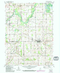
1959 Map of Mentone
USGS Topo · Published 1994About this map
The Tippecanoe River meanders through the northern portion of this landscape, its path defined by a series of engineered drainage systems like Birch Ditch and Moore Ditch. This 1959 survey, updated with later aerial data, reveals a rural Indiana agricultural network at a crossroads of three counties: Marshall, Kosciusko, and Fulton. The town of Mentone serves as the primary hub, surrounded by smaller historic points of interest such as Old Tip Town and the settlement of Sevastopol to the south.
Find a feature on this map
60 named features on this map. Tap any name to fly to it.
Don’t see what you’re looking for? This feature index may not catch every label — zoom into the map to look around manually.
Map Details
Editions of this 1959 Mentone Map
3 editions found
Other maps of this area

1953 · Fort Wayne
USGS Topo · 1:250,000

1953 · Chicago
USGS Topo · 1:250,000

1956 · Fort Wayne
USGS Topo · 1:250,000

1957 · Chicago
USGS Topo · 1:250,000

1957 · Inwood
USGS Topo · 1:24,000

1958 · Bourbon
USGS Topo · 1:24,000

1959 · Atwood
USGS Topo · 1:24,000

1959 · Mentone
USGS Topo · 1:24,000

1961 · Silver Lake
USGS Topo · 1:24,000
1961 · Burket
USGS Topo · 1:24,000