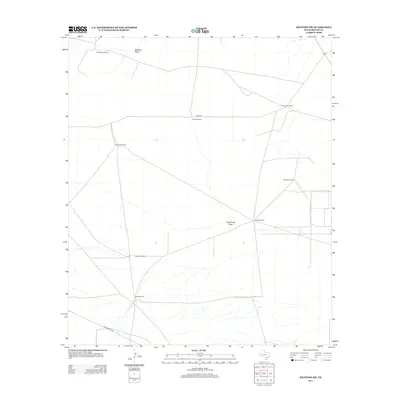
2012 Map of Mentone SW
USGS Topo · Published 2012About this map
Simmons Windmill and McCarty Draw mark the northern reaches of this arid Reeves County landscape, where survival and settlement are tied directly to water access. This 2012 survey reveals a terrain defined by widely dispersed ranching infrastructure, such as Division Windmill and Railroad Windmill, which dot the vast open spaces between ephemeral watercourses. The network of service roads, including Co RD 427 and Ranch Road 2119, provides the primary means of navigating this part of West Texas. Farther south, features like Halamicek Draw and Steel Windmill illustrate the continued reliance on these specific landmarks for orientation and livestock management in a region where the traditional ranching economy persists into the modern era.
Find a feature on this map
12 named features on this map. Tap any name to fly to it.
Don’t see what you’re looking for? This feature index may not catch every label — zoom into the map to look around manually.
Map Details
Editions of this 2012 Mentone SW Map
This is the sole edition of this map. No revisions or reprints were ever made.
Other maps of this area

1921 · Toyah
USGS Topo · 1:125,000

1954 · Pecos
USGS Topo · 1:250,000

1957 · Pecos
USGS Topo · 1:250,000

1961 · Mentone
USGS Topo · 1:24,000

1961 · Anderson Ranch
USGS Topo · 1:24,000

1961 · Sand Lake
USGS Topo · 1:24,000

1961 · Narrow Bow Draw
USGS Topo · 1:24,000
1968 · Halamicek Ranch
USGS Topo · 1:24,000

1968 · Mentone SW
USGS Topo · 1:24,000

1970 · Big Hill
USGS Topo · 1:24,000