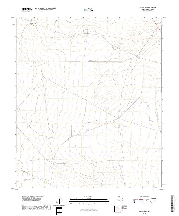
2022 Map of Mentone SW
USGS Topo · Published 2022About this map
Halamicek Draw and McCarty Draw define the drainage patterns of this arid Reeves County landscape, where ephemeral watercourses carve through the West Texas terrain. The map documents a sparsely populated region characterized by vast ranching tracts and an infrastructure of remote corridors like Fence Line Rd and Ranch Rd 2119. These roads and geographic features provide essential context for understanding the 21st-century land use in the Permian Basin area. The presence of Smith Draw in the northern reaches further illustrates the natural hydrological network that dictates the placement of rural boundaries and local transit routes such as Co RD 427.
Find a feature on this map
7 named features on this map. Tap any name to fly to it.
Don’t see what you’re looking for? This feature index may not catch every label — zoom into the map to look around manually.
Map Details
Editions of this 2022 Mentone SW Map
This is the sole edition of this map. No revisions or reprints were ever made.
Other maps of this area

1921 · Toyah
USGS Topo · 1:125,000

1954 · Pecos
USGS Topo · 1:250,000

1957 · Pecos
USGS Topo · 1:250,000

1961 · Mentone
USGS Topo · 1:24,000

1961 · Anderson Ranch
USGS Topo · 1:24,000

1961 · Sand Lake
USGS Topo · 1:24,000

1961 · Narrow Bow Draw
USGS Topo · 1:24,000
1968 · Halamicek Ranch
USGS Topo · 1:24,000

1968 · Mentone SW
USGS Topo · 1:24,000

1970 · Big Hill
USGS Topo · 1:24,000