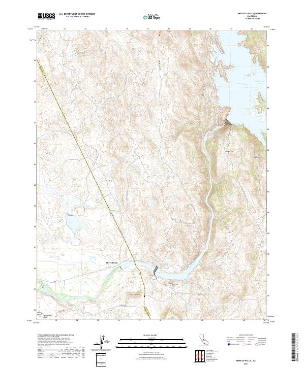
2021 Map of Merced Falls
USGS Topo · Published 2021About this map
Merced Falls sits at the foot of the Sierra Nevada foothills where the Merced River exits the steeper terrain to meet the San Joaquin Valley. This landscape is defined by the transition from the flatlands of the Central Valley to the rugged uplands marked by Table Top Mtn and Bullion Hill. The northern portion of the map is dominated by the sprawling waters of Lake McClure, including the Temperance Arm and Cemetery Ridge. The presence of numerous creeks such as Dry Cr and Browns Cr illustrates the drainage patterns feeding into the river system. Historically, this area served as a critical interface between the mountain resources and the agricultural valley, with transportation routes like Merced Falls Rd and Co Rd J16 connecting the scattered settlements and terrain features like Jones Flat and Cemetery Hill.
Find a feature on this map
29 named features on this map. Tap any name to fly to it.
Don’t see what you’re looking for? This feature index may not catch every label — zoom into the map to look around manually.
Map Details
Editions of this 2021 Merced Falls Map
This is the sole edition of this map. No revisions or reprints were ever made.
Other maps of this area

1893 · Sonora
USGS Topo · 1:125,000

1896 · Sonora
USGS Topo · 1:125,000

1897 · Sonora
USGS Topo · 1:125,000

1898 · Sonora
USGS Topo · 1:125,000

1915 · La Grange
USGS Topo · 1:24,000

1916 · Hopeton
USGS Topo · 1:31,680

1916 · Merced Falls
USGS Topo · 1:24,000
1918 · Snelling
USGS Topo · 1:31,680

1919 · Indian Gulch
USGS Topo · 1:48,000

1919 · Haystack Mountain
USGS Topo · 1:31,680