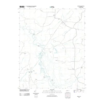
2010 Map of Mercer
USGS Topo · Published 2010About this map
Hatchie River dominates the landscape of western Madison County, winding through a complex system of oxbow lakes and wetlands. This riverine environment is defined by distinctive water bodies such as Horseshoe Lake, Little Pigeon Lake, and Silver Moon Lake, alongside numerous sloughs and ponds that illustrate the natural shifting of the river channel over time. The presence of McCartys Landing and Old Ferry Landing underscores the historical importance of the waterway for local transport and commerce.
Find a feature on this map
73 named features on this map. Tap any name to fly to it.
Don’t see what you’re looking for? This feature index may not catch every label — zoom into the map to look around manually.
Map Details
Editions of this 2010 Mercer Map
This is the sole edition of this map. No revisions or reprints were ever made.
Other maps of this area

1950 · Sunnyhill
USGS Topo · 1:24,000

1951 · Sunnyhill
USGS Topo · 1:24,000

1956 · Blytheville
USGS Topo · 1:250,000

1959 · Blytheville
USGS Topo · 1:250,000

1959 · Westover
USGS Topo · 1:24,000

1959 · Denmark
USGS Topo · 1:24,000

1959 · Whiteville
USGS Topo · 1:24,000

1959 · Hillville
USGS Topo · 1:24,000

1961 · Bolivar West
USGS Topo · 1:24,000
1961 · Mercer
USGS Topo · 1:24,000