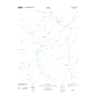
2013 Map of Mercer
USGS Topo · Published 2013About this map
Hatchie River meanders through a dense network of sloughs and oxbow lakes in this western Tennessee landscape. The intricate river hydrology is evidenced by numerous features like Swifts Slough, Running Slough, and The Straight, alongside distinctive ponds and lakes such as Horseshoe Lake, Jennie Pond, and Duncan Lake. Historically significant river access points are marked by McCartys Landing and Old Ferry Landing, indicating the waterway's long-standing role in local transit and the regional economy.
Find a feature on this map
79 named features on this map. Tap any name to fly to it.
Don’t see what you’re looking for? This feature index may not catch every label — zoom into the map to look around manually.
Map Details
Editions of this 2013 Mercer Map
This is the sole edition of this map. No revisions or reprints were ever made.
Other maps of this area

1950 · Sunnyhill
USGS Topo · 1:24,000

1951 · Sunnyhill
USGS Topo · 1:24,000

1956 · Blytheville
USGS Topo · 1:250,000

1959 · Blytheville
USGS Topo · 1:250,000

1959 · Westover
USGS Topo · 1:24,000

1959 · Denmark
USGS Topo · 1:24,000

1959 · Whiteville
USGS Topo · 1:24,000

1959 · Hillville
USGS Topo · 1:24,000

1961 · Bolivar West
USGS Topo · 1:24,000
1961 · Mercer
USGS Topo · 1:24,000