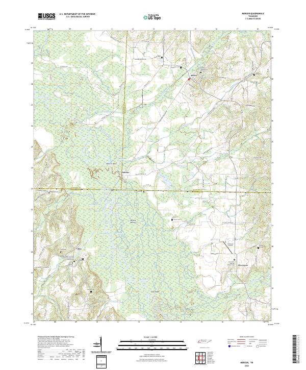
2022 Map of Mercer
USGS Topo · Published 2022About this map
The Hatchie River dominates this West Tennessee landscape, carving a wide, wetland-rich path known as the Hatchie Bottom. The terrain is defined by a complex network of seasonal water and oxbows, including Parker Swamp, Mammy Pond, and Horseshoe Lake. These natural features dictated the settlement patterns of the surrounding communities, which are primarily situated on the higher ground overlooking the river's floodplain.
Find a feature on this map
92 named features on this map. Tap any name to fly to it.
Don’t see what you’re looking for? This feature index may not catch every label — zoom into the map to look around manually.
Map Details
Editions of this 2022 Mercer Map
This is the sole edition of this map. No revisions or reprints were ever made.
Other maps of this area

1950 · Sunnyhill
USGS Topo · 1:24,000

1951 · Sunnyhill
USGS Topo · 1:24,000

1956 · Blytheville
USGS Topo · 1:250,000

1959 · Blytheville
USGS Topo · 1:250,000

1959 · Westover
USGS Topo · 1:24,000

1959 · Denmark
USGS Topo · 1:24,000

1959 · Whiteville
USGS Topo · 1:24,000

1959 · Hillville
USGS Topo · 1:24,000

1961 · Bolivar West
USGS Topo · 1:24,000
1961 · Mercer
USGS Topo · 1:24,000