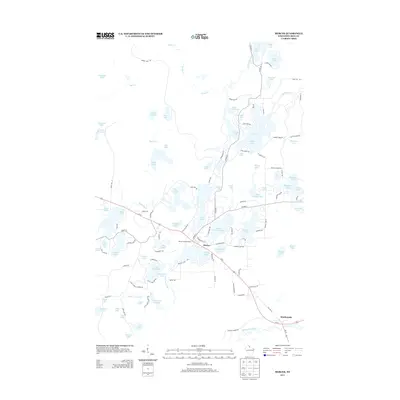
2013 Map of Mercer
USGS Topo · Published 2013About this map
The town of Mercer serves as the central hub of this Iron County landscape, positioned amidst a dense concentration of glacial lakes and waterways. Development is clustered around the Echo Lake and Grand Portage Lake shores, while the Mercer Lookout Tower stands as a prominent landmark overlooking the surrounding forests. The local geography is defined by its complex hydrography, where the Turtle River and Manitowish River navigate through a network including Spider Lake, Oxbow Lake, and San Domingo Lake. To the southeast, the settlement of Manitowish marks a significant point along the winding river. Transportation patterns are anchored by Us-51, with historical transit remnants visible in the form of RR Grade 1. This map captures the established recreational and residential footprints around the water, from the small clusters at Little Martha Lake to the more secluded northern reaches of Lake Ten and Deertail Lake.
Find a feature on this map
119 named features on this map. Tap any name to fly to it.
Don’t see what you’re looking for? This feature index may not catch every label — zoom into the map to look around manually.
Map Details
Editions of this 2013 Mercer Map
This is the sole edition of this map. No revisions or reprints were ever made.
Other maps of this area

1939 · Winchester
USGS Topo · 1:48,000

1940 · Mercer
USGS Topo · 1:48,000

1943 · Ironwood
USGS Topo · 1:48,000

1945 · Mercer
USGS Topo · 1:48,000

1946 · Winchester
USGS Topo · 1:48,000

1947 · Mercer
USGS Topo · 1:48,000

1953 · Ashland
USGS Topo · 1:250,000

1955 · Mercer
USGS Topo · 1:62,500

1955 · Winchester
USGS Topo · 1:62,500

1955 · Wakefield
USGS Topo · 1:62,500