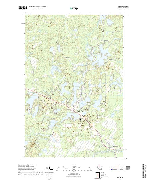
2022 Map of Mercer
USGS Topo · Published 2022About this map
Mercer sits at the heart of this Iron County landscape, a community defined by its proximity to an expansive network of glacial waters including Mercer Lake and San Domingo Lake. The town's grid is surrounded by a dense cluster of water bodies, from the narrow reaches of Spider Lake and Oxbow Lake in the north to the more secluded Little Pike Lake and Pike Lake to the southwest. The presence of the Mercer Cem and various local thoroughfares like Pierpont Rd and Lakeshore Dr reflect a long-established lakefront settlement pattern.
Find a feature on this map
130 named features on this map. Tap any name to fly to it.
Don’t see what you’re looking for? This feature index may not catch every label — zoom into the map to look around manually.
Map Details
Editions of this 2022 Mercer Map
This is the sole edition of this map. No revisions or reprints were ever made.
Other maps of this area

1939 · Winchester
USGS Topo · 1:48,000

1940 · Mercer
USGS Topo · 1:48,000

1943 · Ironwood
USGS Topo · 1:48,000

1945 · Mercer
USGS Topo · 1:48,000

1946 · Winchester
USGS Topo · 1:48,000

1947 · Mercer
USGS Topo · 1:48,000

1953 · Ashland
USGS Topo · 1:250,000

1955 · Mercer
USGS Topo · 1:62,500

1955 · Winchester
USGS Topo · 1:62,500

1955 · Wakefield
USGS Topo · 1:62,500