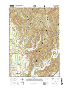
2017 Map of Mercer Lake
USGS Topo · Published 2017About this map
Mercer Lake and its intricate shoreline, including Dahlin Arm and Dowell Arm, form the heart of this coastal Oregon landscape within the Siuslaw National Forest. The map documents a complex coastal ecosystem where freshwater lakes like Munsel Lake and Sutton Lake are separated from the Pacific Ocean by a series of dunes and ridges. To the south, the city of Florence begins to expand northward along US Highway 101, meeting the residential area of Friendly Acres. The topography transitions sharply from the tidal influence of the Siuslaw River and Duncan Inlet to the heights of Cape Mtn and Clover Ridge. This modern survey provides significant detail for local historians, locating the Haring Cem and the distinctively named Enchanted Valley east of the lakes.
Find a feature on this map
87 named features on this map. Tap any name to fly to it.
Don’t see what you’re looking for? This feature index may not catch every label — zoom into the map to look around manually.
Map Details
Editions of this 2017 Mercer Lake Map
This is the sole edition of this map. No revisions or reprints were ever made.
Other maps of this area

1918 · Mapleton
USGS Topo · 1:48,000

1919 · Earl
USGS Topo · 1:48,000

1920 · Siltcoos Lake
USGS Topo · 1:62,500

1920 · Heceta Head
USGS Topo · 1:62,500

1940 · Mapleton
USGS Topo · 1:62,500

1941 · Siltcoos Lake
USGS Topo · 1:62,500

1942 · Heceta Head
USGS Topo · 1:62,500

1942 · Siltcoos Lake
USGS Topo · 1:62,500

1943 · Goodwin Peak
USGS Topo · 1:62,500

1945 · Mapleton
USGS Topo · 1:62,500