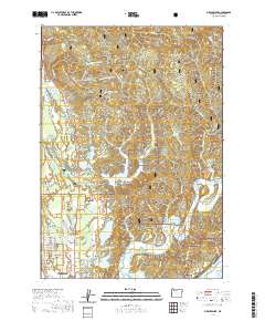
2020 Map of Mercer Lake
USGS Topo · Published 2020About this map
Florence and its northern coastal outskirts are defined by a complex mosaic of freshwater lakes and forested ridges within the Siuslaw National Forest. The landscape is dominated by the irregular shorelines of Mercer Lake and Sutton Lake, which are hemmed in by significant topographical features like Cape Mountain and the deep recesses of Enchanted Valley. Along the coast, a string of smaller water bodies including Mussel Lake, Alder Lake, and Dune Lake sit tucked behind the dunes, reflecting the unique hydrology of the Oregon central coast.
Find a feature on this map
95 named features on this map. Tap any name to fly to it.
Don’t see what you’re looking for? This feature index may not catch every label — zoom into the map to look around manually.
Map Details
Editions of this 2020 Mercer Lake Map
This is the sole edition of this map. No revisions or reprints were ever made.
Other maps of this area

1918 · Mapleton
USGS Topo · 1:48,000

1919 · Earl
USGS Topo · 1:48,000

1920 · Siltcoos Lake
USGS Topo · 1:62,500

1920 · Heceta Head
USGS Topo · 1:62,500

1940 · Mapleton
USGS Topo · 1:62,500

1941 · Siltcoos Lake
USGS Topo · 1:62,500

1942 · Heceta Head
USGS Topo · 1:62,500

1942 · Siltcoos Lake
USGS Topo · 1:62,500

1943 · Goodwin Peak
USGS Topo · 1:62,500

1945 · Mapleton
USGS Topo · 1:62,500