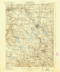
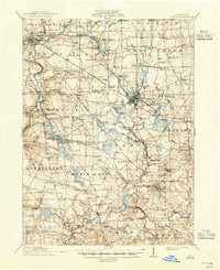
1913 Map of Mercer
USGS Topo · Published 1938About this map
Mercer and Grove City anchor a landscape defined by early 20th-century industry and education, as seen in this 1911 survey. The region is crisscrossed by major rail lines including the Bessemer and Lake Erie RR and the Pennsylvania RR, which supported local extraction at sites like the Number Five Mine. Significant civic landmarks include the State Hospital near the county seat and the State Normal School in the south, reflecting the area's institutional growth.
Find a feature on this map
130 named features on this map. Tap any name to fly to it.
Don’t see what you’re looking for? This feature index may not catch every label — zoom into the map to look around manually.
Map Details
Editions of this 1913 Mercer Map
6 editions found

Other maps of this area

1902 · New Castle
USGS Topo · 1:62,500

1904 · Newcastle
USGS Topo · 1:62,500

1905 · Neshannock
USGS Topo · 1:62,500

1907 · Neshannock
USGS Topo · 1:62,500

1908 · Shenango
USGS Topo · 1:62,500

1908 · Zelienople
USGS Topo · 1:62,500

1909 · Franklin
USGS Topo · 1:62,500

1909 · Butler
USGS Topo · 1:62,500

1910 · Zelienople
USGS Topo · 1:62,500

1910 · Hilliards
USGS Topo · 1:62,500