
1959 Map of Mercer SE
USGS Topo · Published 1960About this map
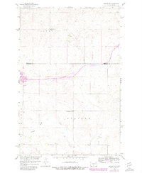
Alta Ch stands as a focal point in this 1959 landscape where the North Dakota prairies of Burleigh and Sheridan counties meet. The survey reveals a rural community structured around its educational and religious institutions, including Johns Lake Sch No 1, School No 2, and Pleasant View Sch. The winding course of Painted Woods Creek cuts through the southern portion of the quadrangle, which is defined by the significant terrain features of Edgemont and Steiber. This map was produced as part of the Department of the Interior program for the Development of the Missouri River Basin, capturing the region's transition into mid-century agricultural modernization. The presence of a Gravel Pit near the county line suggests localized industrial activity supporting the area's road network during this era.
Find a feature on this map
9 named features on this map. Tap any name to fly to it.
Don’t see what you’re looking for? This feature index may not catch every label — zoom into the map to look around manually.
Map Details
Editions of this 1959 Mercer SE Map
2 editions found
Other maps of this area

1954 · McClusky
USGS Topo · 1:250,000

1958 · McClusky
USGS Topo · 1:250,000

1959 · Pickardville
USGS Topo · 1:24,000

1959 · Mercer
USGS Topo · 1:24,000

1959 · Mercer SW
USGS Topo · 1:24,000

1959 · McClusky
USGS Topo · 1:24,000

1960 · Horse Lake
USGS Topo · 1:24,000
1979 · Regan
USGS Topo · 1:24,000

1979 · Canfield Lake
USGS Topo · 1:24,000
1979 · Grass Lake
USGS Topo · 1:24,000