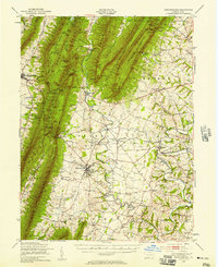
1943 Map of Mercersburg
USGS Topo · Published 1958About this map
The West Branch Conococheague Creek carves a path through the valley between Tuscarora Mountain and North Mountain, defining the industrial and agricultural landscape of Franklin County. This mid-century survey illustrates a region shaped by early Pennsylvania industry, evidenced by the site of Franklin Furnace and the Millers Mill along the creek. The town of Mercersburg serves as a cultural hub, centered on the Mercersburg Academy and surrounded by numerous country schoolhouses like Mount Pleasant Sch and Highland Sch.
Find a feature on this map
110 named features on this map. Tap any name to fly to it.
Don’t see what you’re looking for? This feature index may not catch every label — zoom into the map to look around manually.
Map Details
Editions of this 1943 Mercersburg Map
2 editions found

Other maps of this area

1899 · Hancock
USGS Topo · 1:62,500

1900 · Mercersburg
USGS Topo · 1:62,500

1901 · Hancock
USGS Topo · 1:62,500

1902 · Chambersburg
USGS Topo · 1:62,500

1902 · Mercersburg
USGS Topo · 1:62,500

1909 · Hagerstown
USGS Topo · 1:48,000

1912 · Hagerstown
USGS Topo · 1:62,500

1912 · Williamsport
USGS Topo · 1:62,500

1923 · Shippensburg
USGS Topo · 1:62,500

1925 · Needmore
USGS Topo · 1:48,000