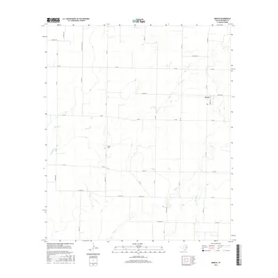
2016 Map of Mereta
USGS Topo · Published 2016About this map
Mereta sits at the center of this rural agricultural landscape in Tom Green County, defined by the expansive Lipan Flat. The settlement is marked by its Po and a grid of local roads, including Broadway, serving the surrounding ranching and farming community. The terrain is characterized by a series of intermittent drainage systems that underscore the arid nature of this West Texas region. Waterways such as Lipan Cr, Dry Lipan Cr, Ninemile Cr, and Hog-Marsh Cr carve subtle paths across the flatlands, eventually leading toward Puddle Cr in the north. The map reveals a highly structured secondary road network, with numbered routes like 4th Rd, 5th Rd, and S Rd 3 providing access to remote homesteads and fields. Family names are preserved in the thoroughfares, such as Hoelscher Rd, Gesch Rd, and Kellermeir Rd, offering valuable leads for local genealogical research.
Find a feature on this map
39 named features on this map. Tap any name to fly to it.
Don’t see what you’re looking for? This feature index may not catch every label — zoom into the map to look around manually.
Map Details
Editions of this 2016 Mereta Map
This is the sole edition of this map. No revisions or reprints were ever made.
Other maps of this area

1891 · Hayrick
USGS Topo · 1:125,000

1892 · San Angelo
USGS Topo · 1:125,000

1894 · Hayrick
USGS Topo · 1:125,000

1921 · Lowake
USGS Topo · 1:31,680

1928 · Wall
USGS Topo · 1:62,500

1954 · San Angelo
USGS Topo · 1:250,000

1957 · Eola
USGS Topo · 1:62,500

1957 · Miles
USGS Topo · 1:62,500

1957 · Harriet
USGS Topo · 1:62,500

1957 · Wall
USGS Topo · 1:62,500