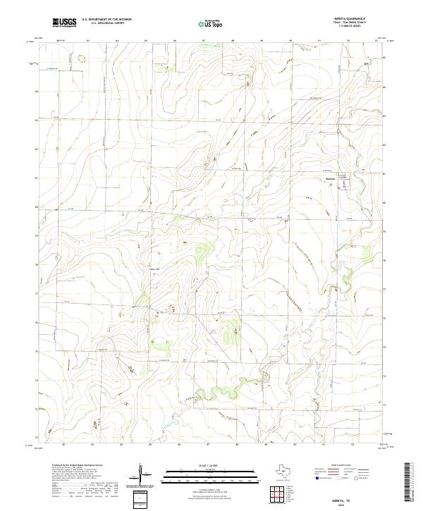
2022 Map of Mereta
USGS Topo · Published 2022About this map
Lipan Flat dominates this portion of the Concho Valley region, where the high plains of West Texas meet a network of seasonal watercourses. The small settlement of Mereta serves as the local anchor, situated near the intersection of Grand Ave and FM 1692. This landscape is defined by its agricultural layout, with a grid of rural roads such as Gesch Rd, Kellermeir Rd, and Mullins Crossing Rd dividing the open terrain. The drainage patterns of the area are clearly visible, characterized by the winding paths of Lipan Cr, Dry Lipan Cr, and the smaller Hog Marsh Cr. These intermittent streams dictate the local topography, carving shallow depressions across the flat farmland and influencing the placement of homesteads and farm-to-market roads like FM 380 and FM 765 that connect this rural community to the wider county.
Find a feature on this map
39 named features on this map. Tap any name to fly to it.
Don’t see what you’re looking for? This feature index may not catch every label — zoom into the map to look around manually.
Map Details
Editions of this 2022 Mereta Map
This is the sole edition of this map. No revisions or reprints were ever made.
Other maps of this area

1891 · Hayrick
USGS Topo · 1:125,000

1892 · San Angelo
USGS Topo · 1:125,000

1894 · Hayrick
USGS Topo · 1:125,000

1921 · Lowake
USGS Topo · 1:31,680

1928 · Wall
USGS Topo · 1:62,500

1954 · San Angelo
USGS Topo · 1:250,000

1957 · Eola
USGS Topo · 1:62,500

1957 · Miles
USGS Topo · 1:62,500

1957 · Harriet
USGS Topo · 1:62,500

1957 · Wall
USGS Topo · 1:62,500