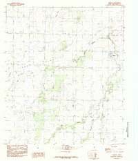
1984 Map of Mereta
USGS Topo · Published 1984About this map
Mereta anchors the eastern edge of this mid-1980s landscape, situated in an area defined by the broad expanse of Lipan Flat. The terrain is characterized by a network of ephemeral and intermittent watercourses, including the descriptive Dry Lipan Creek, Ninemile Creek, and the more uniquely named Hog Marsh Creek and Snake Creek. These drainages highlight the subtle topographic shifts across the Tom Green County plains.
Find a feature on this map
11 named features on this map. Tap any name to fly to it.
Don’t see what you’re looking for? This feature index may not catch every label — zoom into the map to look around manually.
Map Details
Editions of this 1984 Mereta Map
This is the sole edition of this map. No revisions or reprints were ever made.
Other maps of this area

1891 · Hayrick
USGS Topo · 1:125,000

1892 · San Angelo
USGS Topo · 1:125,000

1894 · Hayrick
USGS Topo · 1:125,000

1921 · Lowake
USGS Topo · 1:31,680

1928 · Wall
USGS Topo · 1:62,500

1954 · San Angelo
USGS Topo · 1:250,000

1957 · Eola
USGS Topo · 1:62,500

1957 · Miles
USGS Topo · 1:62,500

1957 · Harriet
USGS Topo · 1:62,500

1957 · Wall
USGS Topo · 1:62,500