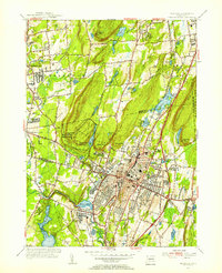
1955 Map of Meriden
USGS Topo · Published 1956About this map
The Hanging Hills dominate the central landscape of this 1955 survey, rising sharply above the urban center of Meriden. This terrain is punctuated by landmarks such as West Peak and its namesake West Peak State Park, where the Stone Tower looks out over a valley of reservoirs including Kenmere Res and Hallmere Res. The industrial and social infrastructure of mid-century Connecticut is well-defined, featuring the Undercliff Sanatorium, the State School For Boys, and the Meriden Airport. To the north, the town of Southington is bordered by family-named localities like Stillmans Corner and Bishops Corner. The Quinnipiac River winds through the southern portion near Hanover Pond, while the New York New Haven and Hartford railroad and the Wilbur Cross Parkway facilitate the region's transport corridor between New Haven and Hartford.
Find a feature on this map
68 named features on this map. Tap any name to fly to it.
Don’t see what you’re looking for? This feature index may not catch every label — zoom into the map to look around manually.
Map Details
Editions of this 1955 Meriden Map
3 editions found
Other maps of this area

1892 · New Haven
USGS Topo · 1:62,500

1892 · Meriden
USGS Topo · 1:62,500

1893 · Guilford
USGS Topo · 1:62,500

1893 · Middletown
USGS Topo · 1:62,500

1893 · Meriden
USGS Topo · 1:62,500

1906 · Farmington
USGS Topo · 1:125,000

1921 · New Haven
USGS Topo · 1:62,500

1928 · Cromwell
USGS Topo · 1:24,000

1943 · Durham
USGS Topo · 1:25,000

1944 · Hartford South
USGS Topo · 1:31,680