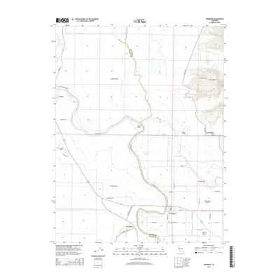
2015 Map of Meridian
USGS Topo · Published 2015About this map
The Sacramento River carves a sinuous path through this segment of the Sacramento Valley, defining the boundary between Colusa and Sutter counties. The settlement of Meridian sits prominently along the river's eastern bend, supported by a network of rural roads like N Meridian Rd and Central St. To the east, the dramatic rising slopes of the Sutter Buttes contrast sharply with the surrounding flat agricultural basin. This landscape is a complex hydraulic environment where Butte Creek and Butte Slough navigate the lowlands, while landmarks such as Moons Bend and Wood Lake indicate the river's historical shifts. Genealogists and local historians will find value in the precise location of the Meridian Cemetery and small communities like Sycamore and West Butte that anchor this corner of the Central Valley.
Find a feature on this map
45 named features on this map. Tap any name to fly to it.
Don’t see what you’re looking for? This feature index may not catch every label — zoom into the map to look around manually.
Map Details
Editions of this 2015 Meridian Map
This is the sole edition of this map. No revisions or reprints were ever made.
Other maps of this area

1888 · Marysville
USGS Topo · 1:125,000

1891 · Marysville
USGS Topo · 1:125,000

1894 · Marysville
USGS Topo · 1:125,000

1895 · Marysville
USGS Topo · 1:125,000

1906 · Maxwell
USGS Topo · 1:62,500

1907 · Colusa
USGS Topo · 1:62,500

1911 · Sanborn Slough
USGS Topo · 1:31,680

1911 · Grimes
USGS Topo · 1:31,680

1912 · Marysville Buttes
USGS Topo · 1:31,680

1912 · Pennington
USGS Topo · 1:31,680