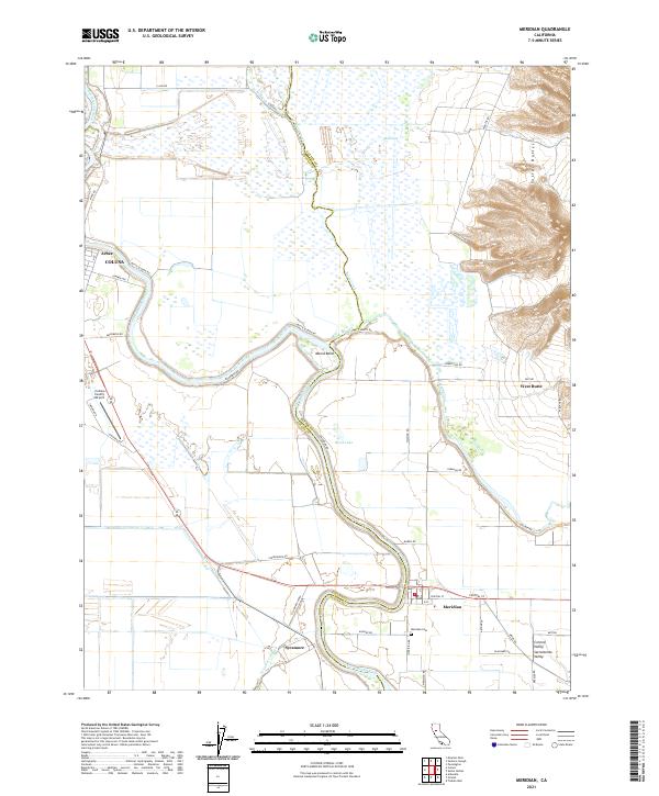
2021 Map of Meridian
USGS Topo · Published 2021About this map
Meridian and the surrounding agricultural landscape of the Central Valley define this modern survey at the junction of Sutter and Colusa counties. The town site, situated along a sharp bend of the Sacramento River, is supported by a network of drainage features and bypasses including the Sycamore Cutoff, Butte Slough, and Sycamore Slough. To the east, the terrain rises abruptly into the Sutter Buttes, contrasting with the low-lying wetlands of the Butte Sink. This map details the local road infrastructure used by the farming community, from Decker Rd to Pass Rd, and identifies local landmarks such as the Meridian Cem and Colusa County Airport. The settlement pattern follows the river's path, with smaller locations like Arbee, Sycamore, and Moons Bend punctuating the productive valley floor.
Find a feature on this map
48 named features on this map. Tap any name to fly to it.
Don’t see what you’re looking for? This feature index may not catch every label — zoom into the map to look around manually.
Map Details
Editions of this 2021 Meridian Map
This is the sole edition of this map. No revisions or reprints were ever made.
Other maps of this area

1888 · Marysville
USGS Topo · 1:125,000

1891 · Marysville
USGS Topo · 1:125,000

1894 · Marysville
USGS Topo · 1:125,000

1895 · Marysville
USGS Topo · 1:125,000

1906 · Maxwell
USGS Topo · 1:62,500

1907 · Colusa
USGS Topo · 1:62,500

1911 · Sanborn Slough
USGS Topo · 1:31,680

1911 · Grimes
USGS Topo · 1:31,680

1912 · Marysville Buttes
USGS Topo · 1:31,680

1912 · Pennington
USGS Topo · 1:31,680