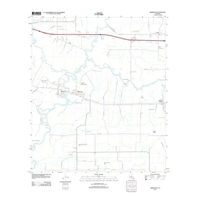
2012 Map of Mermentau
USGS Topo · Published 2012About this map
The Mermentau River winds through this Jefferson Davis Parish landscape, anchoring a series of small Cajun prairie settlements. In the center of the sheet, the town of Mermentau sits at the junction of the river and the Old Spanish Trl, supported by the Mermentau Water Treatment Facility. To the east, the communities of Midland and Egan highlight the region's agricultural and industrial dual-identity, with the latter serving as a hub for the Egan Oil and Gas Field.
Find a feature on this map
74 named features on this map. Tap any name to fly to it.
Don’t see what you’re looking for? This feature index may not catch every label — zoom into the map to look around manually.
Map Details
Editions of this 2012 Mermentau Map
This is the sole edition of this map. No revisions or reprints were ever made.
Other maps of this area

1946 · Morse
USGS Topo · 1:31,680

1946 · Lake Arthur
USGS Topo · 1:31,680

1946 · Mermentau
USGS Topo · 1:31,680

1946 · Jennings
USGS Topo · 1:31,680

1947 · Evangeline
USGS Topo · 1:31,680

1947 · Hathaway
USGS Topo · 1:31,680

1947 · Iota
USGS Topo · 1:31,680

1949 · Gueydan
USGS Topo · 1:31,680

1949 · Estherwood
USGS Topo · 1:31,680

1952 · Lake Charles
USGS Topo · 1:250,000