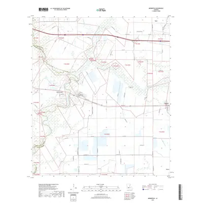
2018 Map of Mermentau
USGS Topo · Published 2018About this map
The Mermentau River winds through the borderlands of Acadia and Jefferson Davis Parishes, anchoring a landscape defined by its intricate waterways and rice-farming heritage. This 2018 survey documents the village of Mermentau at a significant bend in the river, where the Railroad Ave corridor and the historic Old Spanish Trl intersect. The terrain is a network of drainage and irrigation, featuring the Bayou des Cannes, Marmont Gully, and the Midland Canal. Genealogists will find notable value in the location of the Quibodiaux Cem and Le Blanc Cem, alongside family-named landmarks like Duhon Cemetery Rd. From the crossroads at Midland to the northern settlement of Egan, the map illustrates a rural Cajun prairie economy that remains tied to the land's natural hydrology and historic transport routes.
Find a feature on this map
73 named features on this map. Tap any name to fly to it.
Don’t see what you’re looking for? This feature index may not catch every label — zoom into the map to look around manually.
Map Details
Editions of this 2018 Mermentau Map
This is the sole edition of this map. No revisions or reprints were ever made.
Other maps of this area

1946 · Morse
USGS Topo · 1:31,680

1946 · Lake Arthur
USGS Topo · 1:31,680

1946 · Mermentau
USGS Topo · 1:31,680

1946 · Jennings
USGS Topo · 1:31,680

1947 · Evangeline
USGS Topo · 1:31,680

1947 · Hathaway
USGS Topo · 1:31,680

1947 · Iota
USGS Topo · 1:31,680

1949 · Gueydan
USGS Topo · 1:31,680

1949 · Estherwood
USGS Topo · 1:31,680

1952 · Lake Charles
USGS Topo · 1:250,000