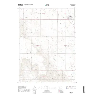
2017 Map of Merna
USGS Topo · Published 2017About this map
Merna stands at the northern edge of this Nebraska landscape, characterized by a transition from high plains plateaus to deep drainage systems. The town site is structured around W Sommer Ave and E Center Ave, reflecting the organized growth of this Custer County community. Just outside the settlement limits, the Merna Cem serves as a local landmark. The surrounding terrain is defined by a series of prominent valleys and topographical features, including Ortello Valley and Dale Valley to the north, and Turner Valley and Union Valley to the south. Central to the map is the West Table, a high flatland that eventually breaks away into the erosion-carved depths of Yellow Dog Canyon and Custer Canyon. This area is drained by the meandering S Br Mud Cr, illustrating the rugged hydraulic patterns of the High Plains.
Find a feature on this map
37 named features on this map. Tap any name to fly to it.
Don’t see what you’re looking for? This feature index may not catch every label — zoom into the map to look around manually.
Map Details
Editions of this 2017 Merna Map
This is the sole edition of this map. No revisions or reprints were ever made.
Other maps of this area

1951 · Broken Bow SW
USGS Topo · 1:24,000

1951 · Lillian
USGS Topo · 1:24,000

1951 · Callaway NW
USGS Topo · 1:24,000

1951 · Anselmo
USGS Topo · 1:24,000

1951 · Broken Bow
USGS Topo · 1:24,000

1951 · Merna
USGS Topo · 1:24,000

1951 · Anselmo SW
USGS Topo · 1:24,000

1951 · Callaway SE
USGS Topo · 1:24,000

1951 · Callaway
USGS Topo · 1:24,000

1955 · Broken Bow
USGS Topo · 1:250,000