
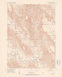
1951 Map of Callaway SE
USGS Topo · Published 1953About this map
The South Loup River winds through the southern reaches of this Custer County landscape, carving a wide valley floor characterized by tight meanders and seasonal drainage channels. The northern portion of the map is dominated by the elevated terrain of Ryno Table, a high plateau dissected by deep ravines including Yellow Dog Canyon and Custer Canyon. This early 1950s survey reveals a rural society structured around local education, evidenced by the dense distribution of country schools across the townships. Many of these institutions, such as Cement Sch and Sunny Side Sch, are positioned along the small waterways and tributaries like Spring Creek, reflecting the importance of creek valleys for early settlement and road placement in this part of the Great Plains.
Find a feature on this map
14 named features on this map. Tap any name to fly to it.
Don’t see what you’re looking for? This feature index may not catch every label — zoom into the map to look around manually.
Map Details
Editions of this 1951 Callaway SE Map
2 editions found
Other maps of this area

1951 · Broken Bow SW
USGS Topo · 1:24,000

1951 · Callaway NW
USGS Topo · 1:24,000

1951 · Broken Bow
USGS Topo · 1:24,000

1951 · Merna
USGS Topo · 1:24,000

1951 · Callaway
USGS Topo · 1:24,000

1951 · Eddyville NW
USGS Topo · 1:24,000

1951 · Oconto NW
USGS Topo · 1:24,000

1951 · Oconto
USGS Topo · 1:24,000

1955 · Broken Bow
USGS Topo · 1:250,000

1956 · Broken Bow
USGS Topo · 1:250,000