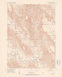
1951 Map of Callaway SE
USGS Topo · Published 1953About this map
The South Loup River winds through the southern reaches of this Custer County landscape, defining the local drainage and topography in the early 1950s. The region is characterized by significant natural landmarks such as Ryno Table and several deeply cut drainages including Yellow Dog Canyon and Custer Canyon. This survey captures a rural Nebraska education network at its peak, mapping numerous country schools that served the surrounding farmsteads. These localized centers of community include Spring Creek Sch, Cement Sch, Sunny Side Sch, Ryno Sch, Maier Sch, Custer Sch, and Center Sch. The reliance on these small, distributed schools suggests a landscape of small family holdings before the significant agricultural consolidation and school district reorganizations of the later 20th century. Feeders like Spring Creek and the seasonal flows through Union Valley further illustrate the intricate hydrologic patterns of the Nebraska loess hills.
Find a feature on this map
14 named features on this map. Tap any name to fly to it.
Don’t see what you’re looking for? This feature index may not catch every label — zoom into the map to look around manually.
Map Details
Editions of this 1951 Callaway SE Map
2 editions found
Other maps of this area

1951 · Broken Bow SW
USGS Topo · 1:24,000

1951 · Callaway NW
USGS Topo · 1:24,000

1951 · Broken Bow
USGS Topo · 1:24,000

1951 · Merna
USGS Topo · 1:24,000

1951 · Callaway SE
USGS Topo · 1:24,000

1951 · Callaway
USGS Topo · 1:24,000

1951 · Eddyville NW
USGS Topo · 1:24,000

1951 · Oconto NW
USGS Topo · 1:24,000

1951 · Oconto
USGS Topo · 1:24,000

1955 · Broken Bow
USGS Topo · 1:250,000