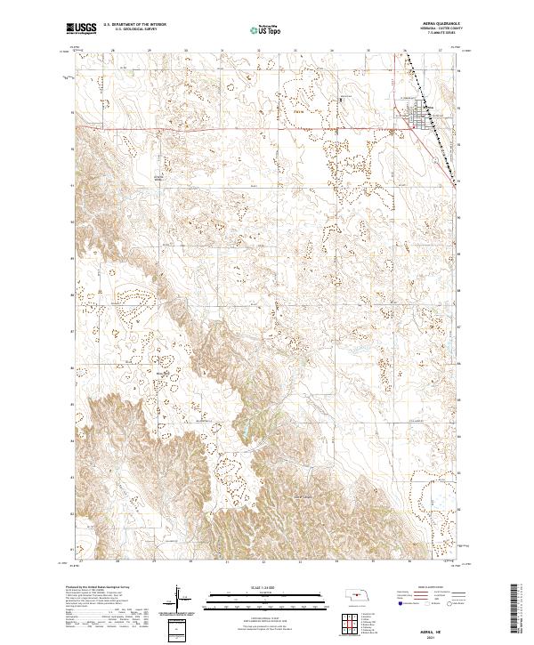
2021 Map of Merna
USGS Topo · Published 2021About this map
Merna occupies the northeastern corner of this Custer County landscape, a vital agricultural hub defined by its grid of village streets and its proximity to the Merna Cem. The surrounding terrain transitions from the high, flat expanses of the West Table into a complex network of drainage valleys and canyons. Seasonal watercourses like the S Br Mud Cr carve through the land, leading into prominent topographical features such as Ortello Valley and Dale Valley. The map reveals a deeply etched countryside where Custer Canyon, Union Valley, and the colorfully named Yellow Dog Canyon dictate the placement of rural section roads. This survey illustrates the enduring patterns of Nebraska's Sandhills-edge ranching and farming country, where long-established routes like Old Hwy 2 and Victoria Springs Rd provide the primary links between isolated homesteads and the central settlement.
Find a feature on this map
43 named features on this map. Tap any name to fly to it.
Don’t see what you’re looking for? This feature index may not catch every label — zoom into the map to look around manually.
Map Details
Editions of this 2021 Merna Map
This is the sole edition of this map. No revisions or reprints were ever made.
Other maps of this area

1951 · Broken Bow SW
USGS Topo · 1:24,000

1951 · Lillian
USGS Topo · 1:24,000

1951 · Callaway NW
USGS Topo · 1:24,000

1951 · Anselmo
USGS Topo · 1:24,000

1951 · Broken Bow
USGS Topo · 1:24,000

1951 · Merna
USGS Topo · 1:24,000

1951 · Anselmo SW
USGS Topo · 1:24,000

1951 · Callaway SE
USGS Topo · 1:24,000

1951 · Callaway
USGS Topo · 1:24,000

1955 · Broken Bow
USGS Topo · 1:250,000