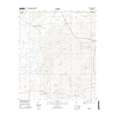
2015 Map of Merrill
USGS Topo · Published 2015About this map
The confluence of the Leaf River and Chickasawhay River creates the Pascagoula River at Merrill, a significant geographical junction in George County. This 2015 survey details the river-dominated landscape, where numerous oxbows and river-side features like Booger Hole Slough and Cochran Dead River mark the ancient movements of these waterways. The settlement pattern follows the higher ground between these drainages, with the communities of Bexley, Crossroads, and Central connected by a network of rural roads. Genealogists will find a high density of family-named burial sites across the landscape, including Woodard Cem, Holmes Cem, Eubanks Cem, and the Eubanks-Dickerson Cem. The terrain is also defined by its river eddies, such as Round Eddy and Davis Eddy, which suggest the historic importance of the river systems for local navigation and recreation.
Find a feature on this map
110 named features on this map. Tap any name to fly to it.
Don’t see what you’re looking for? This feature index may not catch every label — zoom into the map to look around manually.
Map Details
Editions of this 2015 Merrill Map
This is the sole edition of this map. No revisions or reprints were ever made.
Other maps of this area

1941 · Lucedale
USGS Topo · 1:62,500

1943 · Lucedale
USGS Topo · 1:62,500

1947 · Beaumont
USGS Topo · 1:62,500

1947 · Benndale
USGS Topo · 1:62,500

1949 · Beaumont
USGS Topo · 1:62,500

1949 · Benndale
USGS Topo · 1:62,500

1953 · Hattiesburg
USGS Topo · 1:250,000

1953 · Mobile
USGS Topo · 1:250,000

1957 · Mobile
USGS Topo · 1:250,000

1958 · Hattiesburg
USGS Topo · 1:250,000