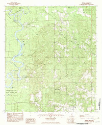
1982 Map of Merrill
USGS Topo · Published 1982About this map
The confluence of the Chickasawhay River and the Leaf River forms the Pascagoula River at the historic settlement of Merrill. This 1982 survey documents a landscape defined by this massive river system and its winding oxbows, such as Smith Dead River and Cochran Dead River. The Illinois Central Gulf Railroad cuts through the northern half of the map, serving the community of Bexley and providing a vital transport corridor parallel to Toms Creek.
Find a feature on this map
45 named features on this map. Tap any name to fly to it.
Don’t see what you’re looking for? This feature index may not catch every label — zoom into the map to look around manually.
Map Details
Editions of this 1982 Merrill Map
This is the sole edition of this map. No revisions or reprints were ever made.
Other maps of this area

1941 · Lucedale
USGS Topo · 1:62,500

1943 · Lucedale
USGS Topo · 1:62,500

1947 · Beaumont
USGS Topo · 1:62,500

1947 · Benndale
USGS Topo · 1:62,500

1949 · Beaumont
USGS Topo · 1:62,500

1949 · Benndale
USGS Topo · 1:62,500

1953 · Hattiesburg
USGS Topo · 1:250,000

1953 · Mobile
USGS Topo · 1:250,000

1957 · Mobile
USGS Topo · 1:250,000

1958 · Hattiesburg
USGS Topo · 1:250,000