
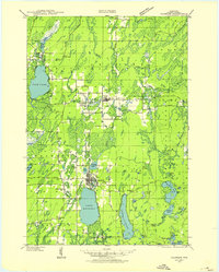
1990 Map of Merrill
USGS Topo · Published 1991About this map
The Wisconsin River corridor anchors this Northwoods landscape during a period of shifting land use from industrial rail toward conservation and recreation. The Soo Line tracks and an extensive Old RR Grade trace the legacy of the region's logging and transit history, connecting the regional hubs of Merrill and Antigo. To the north, the Harrison Hills rise above a dense network of water bodies, including Pelican Lake and the Spirit River Flowage, marking a terrain shaped by glacial activity.
Find a feature on this map
110 named features on this map. Tap any name to fly to it.
Don’t see what you’re looking for? This feature index may not catch every label — zoom into the map to look around manually.
Map Details
Editions of this 1990 Merrill Map
This is the sole edition of this map. No revisions or reprints were ever made.
Other maps of this area

1899 · Wausau
USGS Topo · 1:125,000

1902 · Wausau
USGS Topo · 1:125,000

1902 · Marathon
USGS Topo · 1:125,000

1939 · Mc Cord
USGS Topo · 1:48,000

1939 · Cassian
USGS Topo · 1:48,000
1939 · Crandon
USGS Topo · 1:48,000

1940 · Parrish
USGS Topo · 1:48,000

1940 · Monico
USGS Topo · 1:48,000

1940 · Rhinelander
USGS Topo · 1:48,000
1941 · Crandon
USGS Topo · 1:48,000