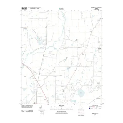
2011 Map of Merrillville
USGS Topo · Published 2011About this map
The Ochlockonee River defines the central topography of this Georgia landscape, winding southward toward the Confederate Bridge. Scattered rural settlements and crossroads communities like Merrillville, Fredonia, and Pasco are connected by a network of named country roads, including Egg and Butter Rd S and Fredonia Church Dirt Rd. The area is notably dense with burial grounds of genealogical significance, including Saint Georges Cemetery, Springhill Cemetery, and Little Ochlocknee Cemetery.
Find a feature on this map
84 named features on this map. Tap any name to fly to it.
Don’t see what you’re looking for? This feature index may not catch every label — zoom into the map to look around manually.
Map Details
Editions of this 2011 Merrillville Map
This is the sole edition of this map. No revisions or reprints were ever made.
Other maps of this area

1953 · Dothan
USGS Topo · 1:250,000

1953 · Waycross
USGS Topo · 1:250,000

1954 · Dothan
USGS Topo · 1:250,000

1954 · Valdosta
USGS Topo · 1:250,000

1954 · Tallahassee
USGS Topo · 1:250,000

1955 · Dothan
USGS Topo · 1:250,000

1956 · Cairo
USGS Topo · 1:62,500

1957 · Thomasville
USGS Topo · 1:62,500

1958 · Valdosta
USGS Topo · 1:250,000

1958 · Waycross
USGS Topo · 1:250,000