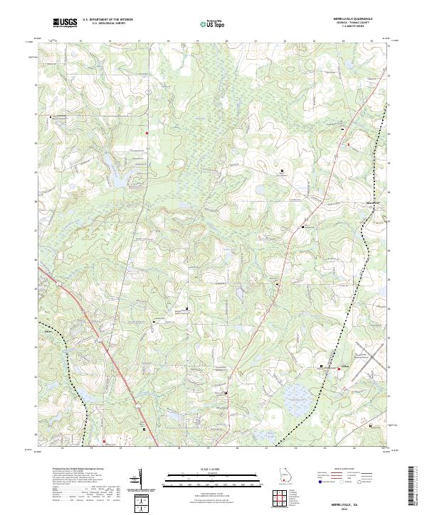
2024 Map of Merrillville
USGS Topo · Published 2024About this map
The Ochlockonee River and its numerous tributaries, including Gully Branch and Good Water Creek, define this rural section of Thomas County. Small crossroads communities like Merrillville, Dillon, and Pasco anchor the landscape, which is largely characterized by agrarian development and family-linked tracts. For genealogists, the map is remarkably dense with burial sites and rural congregations, from the Little Ochlockonee Baptist Church Cem in the northwest to the Saint Marys Cem near the southern boundary. Significant infrastructure is represented by the Thomasville Regional Airport on the eastern edge. The map captures a contemporary look at traditional Georgia land divisions, where residential lanes like Dixie Chastain Rd and Hansell Chastain Rd reflect the enduring legacy of local families along the river basin and its associated wetlands like Robin Bay.
Find a feature on this map
123 named features on this map. Tap any name to fly to it.
Don’t see what you’re looking for? This feature index may not catch every label — zoom into the map to look around manually.
Map Details
Editions of this 2024 Merrillville Map
This is the sole edition of this map. No revisions or reprints were ever made.
Other maps of this area

1953 · Dothan
USGS Topo · 1:250,000

1953 · Waycross
USGS Topo · 1:250,000

1954 · Dothan
USGS Topo · 1:250,000

1954 · Valdosta
USGS Topo · 1:250,000

1954 · Tallahassee
USGS Topo · 1:250,000

1955 · Dothan
USGS Topo · 1:250,000

1956 · Cairo
USGS Topo · 1:62,500

1957 · Thomasville
USGS Topo · 1:62,500

1958 · Valdosta
USGS Topo · 1:250,000

1958 · Waycross
USGS Topo · 1:250,000