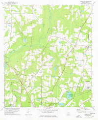
1978 Map of Merrillville
USGS Topo · Published 1978About this map
Ochlockonee River winds through this Thomas County landscape, punctuated by the Confederate Bridge and a series of swampy lowland features like Robin Bay and Pasco Bay. The settlement pattern in the late 1970s is defined by a dense network of country churches that serve as local anchors, including Little Ochlocknee Ch, Spring Hill Ch, and New Shiloh Ch. The Seaboard Coast Line railroad cuts diagonally across the terrain, passing near the small community of Merrillville and the hamlet of Dillon. To the east, the Thomasville Municipal Airport and a small Landing Strip represent the era's infrastructure, while the presence of a Lookout Tower and various sand and clay pits indicate the local forestry and extraction industries.
Find a feature on this map
40 named features on this map. Tap any name to fly to it.
Don’t see what you’re looking for? This feature index may not catch every label — zoom into the map to look around manually.
Map Details
Editions of this 1978 Merrillville Map
This is the sole edition of this map. No revisions or reprints were ever made.
Other maps of this area

1953 · Dothan
USGS Topo · 1:250,000

1953 · Waycross
USGS Topo · 1:250,000

1954 · Dothan
USGS Topo · 1:250,000

1954 · Valdosta
USGS Topo · 1:250,000

1954 · Tallahassee
USGS Topo · 1:250,000

1955 · Dothan
USGS Topo · 1:250,000

1956 · Cairo
USGS Topo · 1:62,500

1957 · Thomasville
USGS Topo · 1:62,500

1958 · Valdosta
USGS Topo · 1:250,000

1958 · Waycross
USGS Topo · 1:250,000