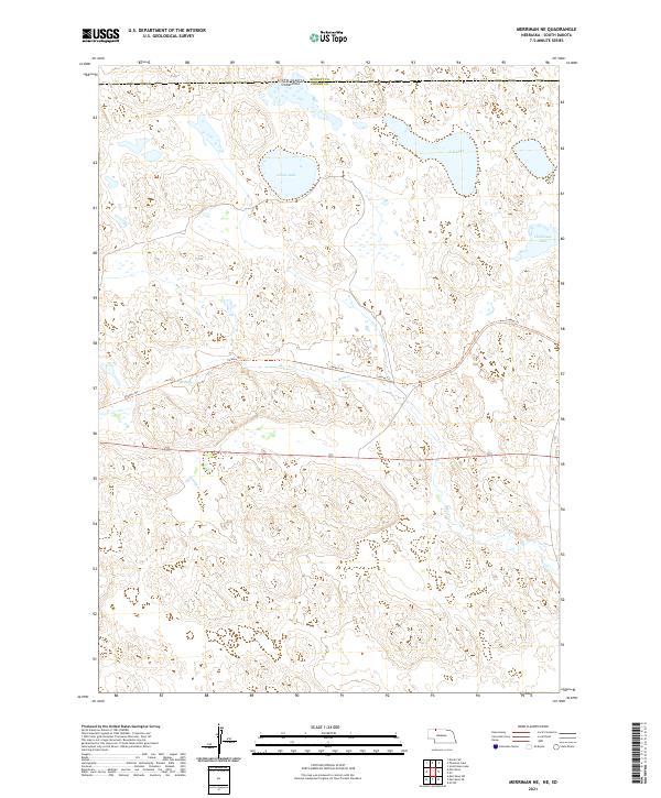
2021 Map of Merriman NE
USGS Topo · Published 2021About this map
Sandhills topography and ephemeral water bodies define this segment of the South Dakota Nebraska border, where Cherry County meets its northern neighbor. The landscape is dominated by a complex network of dunes and depressions, punctuated by significant bodies of water including Goose Lake and S B Lake. This specific terrain illustrates the unique hydrologic character of the Nebraska Sandhills, where the high water table creates large, shallow lakes in the midst of an arid-looking dune system.
Find a feature on this map
11 named features on this map. Tap any name to fly to it.
Don’t see what you’re looking for? This feature index may not catch every label — zoom into the map to look around manually.
Map Details
Editions of this 2021 Merriman NE Map
This is the sole edition of this map. No revisions or reprints were ever made.
Other maps of this area

1951 · Merriman
USGS Topo · 1:62,500

1952 · Eli
USGS Topo · 1:62,500

1955 · Martin
USGS Topo · 1:250,000

1957 · Valentine
USGS Topo · 1:250,000

1958 · Martin
USGS Topo · 1:250,000

1959 · Valentine
USGS Topo · 1:250,000

1981 · Phantom Lake
USGS Topo · 1:25,000

1981 · Scotchman Lake
USGS Topo · 1:25,000

1983 · Martin
USGS Topo · 1:100,000
1985 · Eli
USGS Topo · 1:24,000