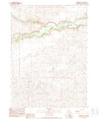
1990 Map of Merriman SE
USGS Topo · Published 1990About this map
The Niobrara River carves a deep, winding channel across the northern section of this Cherry County landscape, creating a stark contrast with the sprawling Sandhills terrain to the south. This 1990 provisional survey documents a region defined by large-scale ranching operations, where isolated homesteads like Simmons Ranch and Yeager Ranch serve as primary landmarks in an otherwise open expanse of undulating hills and blowouts. The hydrology of the area is centered on the river corridor and its tributaries, including Leander Creek, which feeds into the Niobrara from the north. For those researching local land use or family history, the map provides precise locations for long-established holdings such as Cobb Ranch and McGaughey Ranch, reflecting the enduring cattle-ranching heritage of this portion of the Nebraska panhandle.
Find a feature on this map
6 named features on this map. Tap any name to fly to it.
Don’t see what you’re looking for? This feature index may not catch every label — zoom into the map to look around manually.
Map Details
Editions of this 1990 Merriman SE Map
This is the sole edition of this map. No revisions or reprints were ever made.
Other maps of this area

1950 · Doughboy
USGS Topo · 1:62,500

1951 · Merriman
USGS Topo · 1:62,500

1951 · Merriman 4
USGS Topo · 1:62,500

1952 · Eli
USGS Topo · 1:62,500

1952 · Doughboy
USGS Topo · 1:62,500

1957 · Valentine
USGS Topo · 1:250,000

1959 · Valentine
USGS Topo · 1:250,000
1985 · Eli
USGS Topo · 1:24,000

1985 · Cody
USGS Topo · 1:100,000
1985 · Eli SW
USGS Topo · 1:24,000