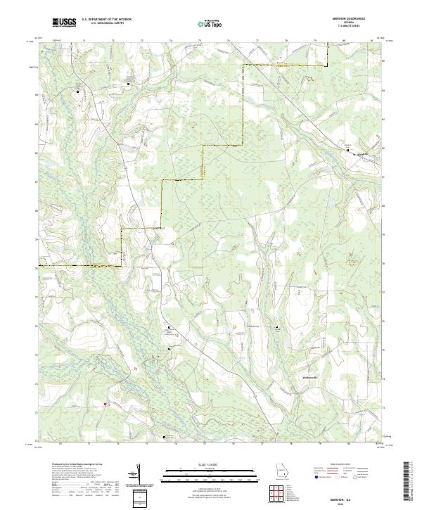
2024 Map of Mershon
USGS Topo · Published 2024About this map
The boundary line between Bacon Co and Pierce Co cuts through a landscape defined by the winding course of the Alabaha River and its numerous tributaries. In this rural Georgia region, the small settlement of Mershon serves as a local hub near the northeast corner, while Walkersville sits further south. The area is heavily marked by its religious and genealogical heritage, with multiple country churches and burial grounds such as Ten-Mile Cem, Shady Grove Baptist Church, and the Henderson Cem distributed across the countryside.
Find a feature on this map
90 named features on this map. Tap any name to fly to it.
Don’t see what you’re looking for? This feature index may not catch every label — zoom into the map to look around manually.
Map Details
Editions of this 2024 Mershon Map
This is the sole edition of this map. No revisions or reprints were ever made.
Other maps of this area

1953 · Waycross
USGS Topo · 1:250,000

1958 · Waycross
USGS Topo · 1:250,000

1971 · Dixie Union
USGS Topo · 1:24,000

1971 · Coffee
USGS Topo · 1:24,000

1971 · Blackshear East
USGS Topo · 1:24,000

1971 · K'ville
USGS Topo · 1:24,000

1971 · Patterson
USGS Topo · 1:24,000

1971 · Alma
USGS Topo · 1:24,000

1971 · Blackshear West
USGS Topo · 1:24,000

1971 · Mershon
USGS Topo · 1:24,000