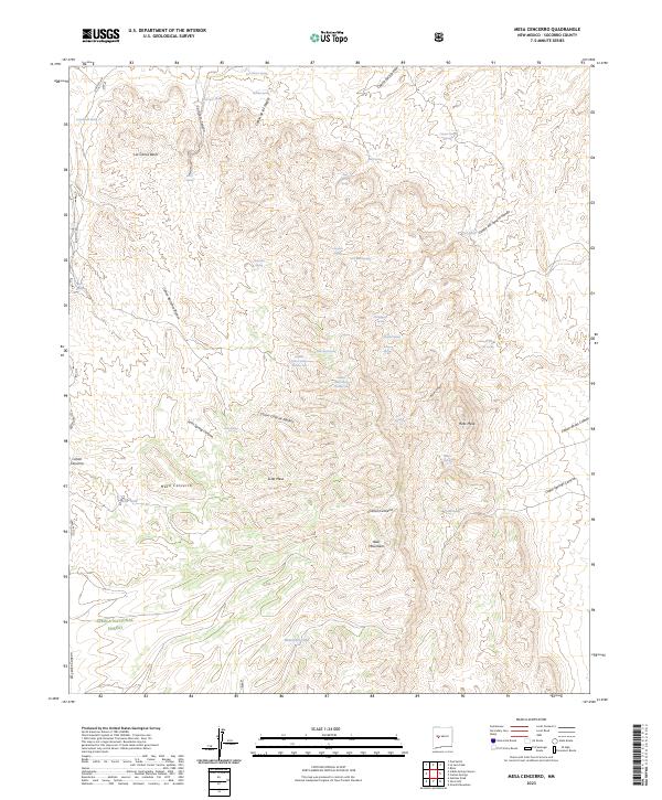
2023 Map of Mesa Cencerro
USGS Topo · Published 2023About this map
The Bear Mountains dominate this high-desert landscape in Socorro County, anchoring the southern portion of the map within the Cibola National Forest. This terrain is characterized by a dense network of canyons and high plateaus, including Mesa Cencerro, Hells Mesa, and Scott Mesa. A clear pattern of historical water reliance is evident through the naming of numerous springs and tanks, which served as vital lifeblood for any activity in this arid environment. Significant water sources like Lumber House Spring Number One and Lumber House Spring Number Two suggest a history of local resource extraction or settlement infrastructure. Other points of interest include Cement Trough Spring and the winding course of Cañon del Alamito, illustrating the complex drainage systems that have carved this portion of New Mexico.
Find a feature on this map
51 named features on this map. Tap any name to fly to it.
Don’t see what you’re looking for? This feature index may not catch every label — zoom into the map to look around manually.
Map Details
Editions of this 2023 Mesa Cencerro Map
This is the sole edition of this map. No revisions or reprints were ever made.
Other maps of this area

1954 · Socorro
USGS Topo · 1:250,000

1958 · Socorro
USGS Topo · 1:250,000

1959 · Magdalena
USGS Topo · 1:62,500

1959 · Riley
USGS Topo · 1:62,500

1962 · Socorro
USGS Topo · 1:250,000

1964 · La Jara Peak
USGS Topo · 1:24,000

1964 · Silver Hill
USGS Topo · 1:24,000

1964 · Gallinas Peak
USGS Topo · 1:24,000

1964 · Puertecito
USGS Topo · 1:24,000
1964 · Mesa Cencerro
USGS Topo · 1:24,000