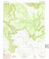
1989 Map of Mesa Cencerro
USGS Topo · Published 1989About this map
Antonio Ortiz and the surrounding tablelands define this high-desert landscape in San Miguel County, where seasonal drainages and vital water sources dictated the patterns of land use. The map reveals a complex network of mesas, including Mesa Apache, West Mesa, and East Mesa, separated by deep canyons such as Cañon de las Mujeres. Water security for livestock is evident through numerous named springs, including Alamito Springs, Chupinas Spring, and Guiverdes Spring, alongside a dense concentration of check dams along Chupinas Creek and Rincon Creek. These features, coupled with various corral sites, reflect a resilient ranching economy adapted to the arid terrain of the late 20th century. The intricate topography of Mesas Cuatas and the named pastures further illustrate how geographic boundaries and natural features organized this territory.
Find a feature on this map
18 named features on this map. Tap any name to fly to it.
Don’t see what you’re looking for? This feature index may not catch every label — zoom into the map to look around manually.
Map Details
Editions of this 1989 Mesa Cencerro Map
This is the sole edition of this map. No revisions or reprints were ever made.
Other maps of this area

1954 · Socorro
USGS Topo · 1:250,000

1958 · Socorro
USGS Topo · 1:250,000

1959 · Magdalena
USGS Topo · 1:62,500

1959 · Riley
USGS Topo · 1:62,500

1962 · Socorro
USGS Topo · 1:250,000

1964 · La Jara Peak
USGS Topo · 1:24,000

1964 · Silver Hill
USGS Topo · 1:24,000

1964 · Gallinas Peak
USGS Topo · 1:24,000

1964 · Puertecito
USGS Topo · 1:24,000
1964 · Mesa Cencerro
USGS Topo · 1:24,000