
1963 Map of Mesa Cherisco
USGS Topo · Published 1965About this map
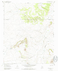
Mesa Cherisco rises above a landscape defined by ranching and vital water access at the boundary of San Miguel and Guadalupe counties. Mapping in the early 1960s reveals a sparse settlement pattern focused on livestock, with family-named outposts such as Boylan Ranch and Pino Ranch situated near reliable drainages. The importance of groundwater is evident in the numerous namesake sources including Pino Spring, Pino Well, Cherisco Well, and Barrajon Well. To the north, Pino Creek and Garita Creek carve through the terrain, while a modern Pipeline cuts across the southern portion of the quadrangle near the settlement of Barrajon. This survey provides a clear view of the arid plateau's transition into the Preston Beck grant, showing how topographic features like Cuervo Hill served as navigational landmarks for those working these remote New Mexico rangelands.
Find a feature on this map
20 named features on this map. Tap any name to fly to it.
Don’t see what you’re looking for? This feature index may not catch every label — zoom into the map to look around manually.
Map Details
Editions of this 1963 Mesa Cherisco Map
2 editions found
Other maps of this area

1892 · Corazon
USGS Topo · 1:125,000

1894 · Corazon
USGS Topo · 1:125,000

1954 · Santa Fe
USGS Topo · 1:250,000

1958 · Santa Fe
USGS Topo · 1:250,000

1963 · Sacaton Draw
USGS Topo · 1:24,000
1963 · Catfish Falls
USGS Topo · 1:24,000
1963 · Bar Y Ranch
USGS Topo · 1:24,000

1963 · Mesita Del Gato
USGS Topo · 1:24,000

1963 · Cuervo
USGS Topo · 1:24,000

1972 · La Silla
USGS Topo · 1:24,000